Hurricane Melissa: The Unprecedented Threat Facing Jamaica
An in-depth look at why Hurricane Melissa is unlike any storm Jamaica has faced in over 170 years. Discover the triple threat of extreme winds, record rainfall, and slow movement creating catastrophic conditions beyond typical hurricane dangers.
In the world of extreme weather, not all Category 5 hurricanes are created equal. Hurricane Melissa, currently bearing down on Jamaica, represents a perfect storm of meteorological factors that make it potentially the most devastating hurricane to hit the island since record-keeping began in 1851.
Beyond the Category 5 Label
When we hear “Category 5 hurricane,” most of us immediately think of the wind speed. And yes, Melissa’s sustained winds of 175 mph are nothing short of catastrophic. But that’s merely the beginning of what makes this storm uniquely dangerous.
What meteorologists are particularly concerned about isn’t just how fast the winds are blowing, but how slowly the storm itself is moving.
“This is a storm the likes of which we have never seen.” - Jamaican official
Moving at just 2 mph—literally slower than walking pace—Hurricane Melissa isn’t passing through Jamaica; it’s parking over the island. This means areas will be subjected to extreme conditions not for hours, but for days.
The Triple Threat: Wind, Rain, and Duration
Amplified Wind Destruction
While coastal regions will face the reported 175 mph winds, Jamaica’s mountainous topography creates an even more alarming scenario. In these highland areas, wind speeds are projected to be 30% stronger than officially reported—potentially reaching a mind-boggling 225 mph. For context, that’s faster than most high-speed trains.
The Prime Minister didn’t mince words: “I don’t believe there is any infrastructure within this region that could withstand a Category 5 storm.” This isn’t hyperbole—buildings specifically designed to withstand hurricanes may not survive Melissa’s onslaught.
Catastrophic Rainfall
While wind gets the headlines, water often causes the most destruction in hurricane scenarios. Melissa is expected to dump up to 40 inches of rain across Jamaica—the equivalent of filling a bathtub and emptying it over every square foot of land.
Combined with the slow movement of the storm, this creates conditions perfect for catastrophic flooding, mudslides, and long-term infrastructure damage.
Unprecedented Duration
Normal hurricanes pass through regions in hours. Melissa will hover over Jamaica for days, subjecting the island to prolonged extreme conditions that will hamper rescue efforts and multiply the destruction exponentially.
When Hurricane Hunters Turn Back
Perhaps the most telling indicator of Melissa’s exceptional power? The Hurricane Hunter aircraft—specially equipped planes designed to fly into the heart of storms to gather critical data—had to abort their mission due to “severe turbulence.” This is meteorological code for conditions so extreme that even these purpose-built aircraft and their experienced crews deemed it too dangerous to continue.
This rare occurrence hasn’t happened in years and signals the extraordinary nature of what’s developing in the Caribbean.
The Human Cost Has Already Begun
Even before making landfall, Melissa has claimed three lives. This early toll underscores the severity of the situation and suggests the grim possibility of a significant humanitarian crisis developing in the storm’s wake.
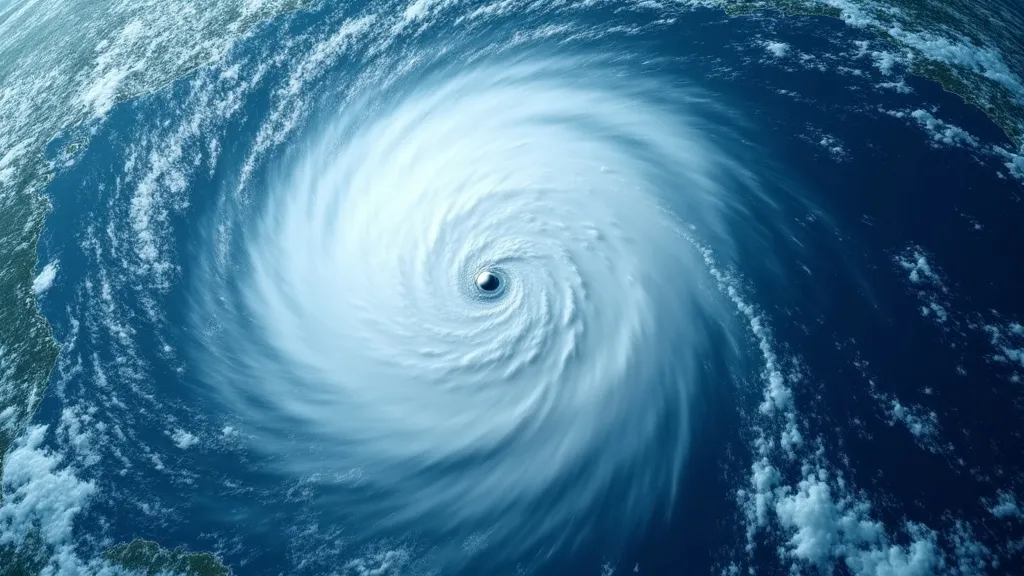
The perfect eye formation visible on satellite imagery might be what meteorologists call “textbook,” but there’s nothing standard about the destructive potential contained within it.
Why Aren’t More People Paying Attention?
Despite the historic nature of this storm, global attention has been somewhat muted. Experts point to “hurricane fatigue”—the psychological phenomenon where frequent exposure to similar threats leads to desensitization.
Put simply, we’ve seen so many hurricanes that many people have become numb to the warnings. But Melissa isn’t just another hurricane—it represents a potentially historic weather event unfolding in real-time.
Preparing for the Unprecedented
The combination of extreme winds, record rainfall, and unusually slow movement creates a scenario that defies normal hurricane preparation protocols. Standard evacuation routes may become unusable for longer periods, emergency services will be stretched beyond normal capacity, and the recovery timeline will likely extend far beyond typical post-hurricane scenarios.
Looking Ahead
As Jamaica faces this extraordinary threat, the coming days will reveal the full impact of Hurricane Melissa. What’s already clear is that this storm represents a confluence of meteorological factors that create a worst-case scenario rarely seen in recorded history.
The true measure of this storm won’t just be in wind speed or rainfall totals, but in the resilience of Jamaica’s people and infrastructure in the face of truly historic conditions. As climate patterns continue to evolve, Melissa may represent not just a historic anomaly, but a sobering preview of future extreme weather possibilities.
For those with connections to Jamaica or the Caribbean, now is the time to check on loved ones and support relief organizations preparing to respond to this unprecedented crisis.